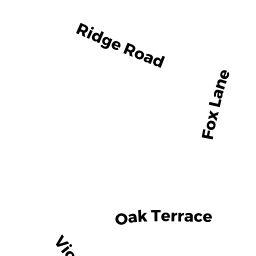
7 VIOLET CR
Owner Information
KNIERIM JOHN T
7 VIOLET CIR
MILFORD, MA 01757


Property Details
7 VIOLET CR is classified as a Single Family Residential (Colonial).
The primary structure on this property was built in 1974. There are 2,352ft2 of built area within this property. There is 2,352ft2 of residential/living space within this property. This property is listed as having 8 rooms.
7 VIOLET CR is valued at $462,200. The land is valued at $173,200 and the structures are valued at $289,000.
This property is in Zone RC. Confirm with local Zoning Board authorities to ensure there are no overlays or other easements on this property.
The most recent deed for 7 VIOLET CR is recorded at the local registrar in Book 51675, Page 166. 7 VIOLET CR was last sold on Monday, October 28, 2013 for $360,000.
Assessment data from fiscal year 2022.
Flood Data
According to the FEMA National Flood Hazard Layer, this property does not appear to be in a flood zone. It may also be in an area not yet reviewed. Nonetheless, confirm this information prior to taking any action.
To view the flood hazards around this property, create a FEMA "Firmette" Map of the area around 7 VIOLET CR.
Broadband Internet Providers
| Provider | Type | Bandwidth (mbps) | |
|---|---|---|---|
| Verizon New England Inc. | Fiber | 940 | 880 |
| Verizon New England Inc. | DSL | 5 | 0 |
| Viasat Inc | Satellite | 100 | 3 |
| Crown Castle Fiber | Fiber | 0 | 0 |
| Comcast | Cable | 1000 | 35 |
| GCI Communication Corp. | Satellite | 0 | 0 |
| HughesNet | Satellite | 25 | 3 |
| VSAT Systems, LLC. | Satellite | 2 | 1 |
Broadband service provider data from December 2020.
Adjacent Properties
- 42 VILLAGE CIRCLE
Residential Condominium owned by LARICK DANICE M TRUSTEE - 43 VILLAGE CIRCLE
Residential Condominium owned by REID MICHAEL - 41 VILLAGE CIRCLE
Residential Condominium owned by ADAMS DONALD W - 7 VILLAGE CIRCLE
Residential Condominium owned by MCCAFFREY MAUREEN TRUSTEE - 8 VILLAGE CIRCLE
Residential Condominium owned by GRELLA STEPHEN & NADINE - 45 VILLAGE CIRCLE
Residential Condominium owned by CLARK ELAINE C - 54 VILLAGE CIRCLE
Residential Condominium owned by SHEEHAN SUSAN A TRUSTEE - 34 VILLAGE CIRCLE
Residential Condominium owned by WOISZWILLO MARY JANE TRUSTEE - 52 VILLAGE CIRCLE
Residential Condominium owned by JACKSON KATHRYN E - 53 VILLAGE CIRCLE
Residential Condominium owned by SINNERY DONALD & JOANNE - 35 VILLAGE CIRCLE
Residential Condominium owned by PEKUNECE STEVEN A & DAWN M - 36 VILLAGE CIRCLE
Residential Condominium owned by MARANHAO SUSAN H - 44 VILLAGE CIRCLE
Residential Condominium owned by FEDERICO LISA M - 51 VILLAGE CIRCLE
Residential Condominium owned by JACKSON KATHLEEN N - 38 VILLAGE CIRCLE
Residential Condominium owned by EVANS DIANNE B TRUSTEE CHASE COLLEEN L TRUSTEE - 39 VILLAGE CIRCLE
Residential Condominium owned by BIAGETTI ANGELO R & JOYCE A - LE - 40 VILLAGE CIRCLE
Residential Condominium owned by THOMPSON JO ANN - 1 VILLAGE CIRCLE
Residential Condominium owned by PETERSON KARI E - 2 VILLAGE CIRCLE
Residential Condominium owned by LEE LORETTA - 3 VILLAGE CIRCLE
Residential Condominium owned by COYLE ELIZABETH A - 4 VILLAGE CIRCLE
Residential Condominium owned by GARINO JEFFREY A - 5 VILLAGE CIRCLE
Residential Condominium owned by KEATING- JOACHIM KAREN M - 6 VILLAGE CIRCLE
Residential Condominium owned by BESSETTE ROSEMARY - 9 VILLAGE CIRCLE
Residential Condominium owned by MOSSMAN DONALD J - 10 VILLAGE CIRCLE
Residential Condominium owned by SCHAFFERT FRED B - 11 VILLAGE CIRCLE
Residential Condominium owned by LEANDRES EDUARDO M - 12 VILLAGE CIRCLE
Residential Condominium owned by ALBERTAZZI MARGARET E - LE & TRUSTEE - 14 VILLAGE CIRCLE
Residential Condominium owned by GOSSELIN LINDA A - 15 VILLAGE CIRCLE
Residential Condominium owned by FAESSLER EUGENE - 16 VILLAGE CIRCLE
Residential Condominium owned by WESOLOWSKI STEFANIE L - 17 VILLAGE CIRCLE
Residential Condominium owned by LUSSIER DANIEL J - 18 VILLAGE CIRCLE
Residential Condominium owned by MAIER ALISON HARLOR - 19 VILLAGE CIRCLE
Residential Condominium owned by SHEA BERNARD - 20 VILLAGE CIRCLE
Residential Condominium owned by SHEA KENNETH & HEATHER - 21 VILLAGE CIRCLE
Residential Condominium owned by PRICKETT JEAN S - 22 VILLAGE CIRCLE
Residential Condominium owned by CARUSO MATTHEW T - 23 VILLAGE CIRCLE
Residential Condominium owned by HARIT SAIGANESH - 24 VILLAGE CIRCLE
Residential Condominium owned by POURRIS CHRISTIE - 25 VILLAGE CIRCLE
Residential Condominium owned by HUTCHINS ROBERT M - 26 VILLAGE CIRCLE
Residential Condominium owned by YANES-TAYLOR ANDREA - 27 VILLAGE CIRCLE
Residential Condominium owned by MACLEOD SCOTT L & ALISON M - 29 VILLAGE CIRCLE
Residential Condominium owned by RIDEUT MARK S & AUDREY H TRSTE - 30 VILLAGE CIRCLE
Residential Condominium owned by BELCHER ELIZABETH J - 31 VILLAGE CIRCLE
Residential Condominium owned by WEBSTER ROBERT F & BEVERLY A TRUSTEES - 32 VILLAGE CIRCLE
Residential Condominium owned by FERGUSON DAVID - 33 VILLAGE CIRCLE
Residential Condominium owned by BLAZYS JOHN T - 37 VILLAGE CIRCLE
Residential Condominium owned by DWYER CYNTHIA M - 46 VILLAGE CIRCLE
Residential Condominium owned by MISTRETTA ANTHONY & DEBORAH A - 47 VILLAGE CIRCLE
Residential Condominium owned by FLUMERE ROBERT H & JUDITH L TR - 48 VILLAGE CIRCLE
Residential Condominium owned by IADAROLA BRENDA J - LE - 49 VILLAGE CIRCLE
Residential Condominium owned by CASSINELLI VERA TRUSTEE - 50 VILLAGE CIRCLE
Residential Condominium owned by PICCINOTTI LISA M - 56 VILLAGE CIRCLE
Residential Condominium owned by HEINSOHN DIANA TRUSTEE - 57 VILLAGE CIRCLE
Residential Condominium owned by DELANEY CONOR - 58 VILLAGE CIRCLE
Residential Condominium owned by DISALVO ALBERT R - 59 VILLAGE CIRCLE
Residential Condominium owned by CHUNG EUNICE M - 0 VILLAGE CIRCLE
Other, Non-Taxable Condominium Common Land owned by VILLAGE AT SILVER HILL CONDO TRUST - 55 VILLAGE CIRCLE
Residential Condominium owned by ROGERS PAUL C & MARY F - 13 VILLAGE CIRCLE
Residential Condominium owned by SAMPSON ROBERT L - 28 VILLAGE CIRCLE
Residential Condominium owned by DALCERO NEIL - 9 VIOLET CR
Single Family Residential owned by CRIMALDI ALBERT A TRUSTEE CRIMALDI GAIL L TRUSTEE - 5 VIOLET CR
Single Family Residential owned by LEBRUN RAYMOND - 7 OAK TR
Single Family Residential owned by PARKIN MARY M - LE